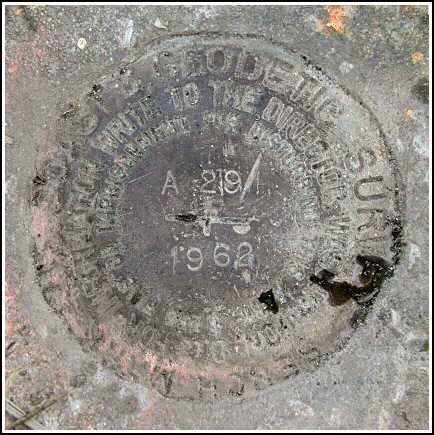
A 29 (HU0141)
A 29
Recovered in Good Condition on September 1, 2003
Spatial/elevation data
| Coordinates | N 38.552266° W 75.136116° |
| Elevation | 12.78 ft. |
| Location | Delaware
Sussex County Frankford Quad |
Mark description
| Type | Bench Mark Disk |
| Setting | Concrete Post |
| Monumented | 1962 by NGS |
| Description (NGS) | NGS Datasheet |
NGS recovery information
Descriptive text
Recovered in good condition.Narrative and photographs
This benchmark disk was found as described in the 1990 recovery note. Utility pole BJ 10 and the brick house are still in place, though the plank fence mentioned in the 1962 description no longer exists. The witness post was not recovered. The disk appears to be in good condition and the designation and date are clearly legible.

