2 USCG
Spatial/elevation data
| Coordinates | N 38.45125° W 75.05495° |
| Elevation | 9.17 ft. |
| Location | Delaware
Sussex County Assawoman Bay Quad |
Mark description
| Type | Survey Disk |
| Setting | Concrete Post |
| Monumented | by U. S. Coast Guard |
| Description (NGS) | NGS Datasheet |
Narrative and photographs
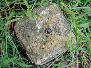
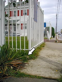
I’m pretty sure I’ve found this mark—or where it used to be. The description, such as it is, checks out and the concrete post obviously once held a disk since the stem remains. It’s not 100% certain that the disk was 2 USCG, especially with the confusion over other marks around the lighthouse, so I won’t mark this either “Found” or “Destroyed” at this time. Additionally, it is possible that the mark could still be used for certain surveys because a significant portion of the stem remains to be able to determine where it was.


