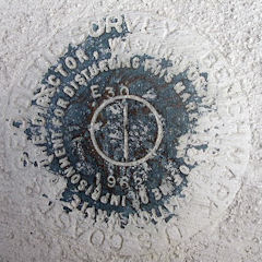
E 30
Spatial/elevation data
| Coordinates | N 38.547966° W 75.113833° |
| Elevation | 10.19 ft. |
| Location | Delaware
Sussex County Bethany Beach Quad |
Mark description
| Type | Bench Mark Disk |
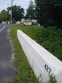
| Setting | Bridge Bannister |
| Monumented | 1962 by NGS |
| Description (NGS) | NGS Datasheet |
NGS recovery information
Descriptive text
Recovered in good condition.Narrative and photographs
This benchmark disk was found as described in the west end of the north bridge bannister. The bridge has been painted white and the number “427” is painted on the eastern end of the bannister. The mark appears to be in good condition; the stamping is legible although much of the disk is covered with white paint. The historic description is reliable, though the following additional information may be useful: the bridge is just southeast of the southeast corner of the Millville Town Hall, near the intersection of Route 26 and Club House Road. The Lord Baltimore High School is now the Lord Baltimore Elementary School.

