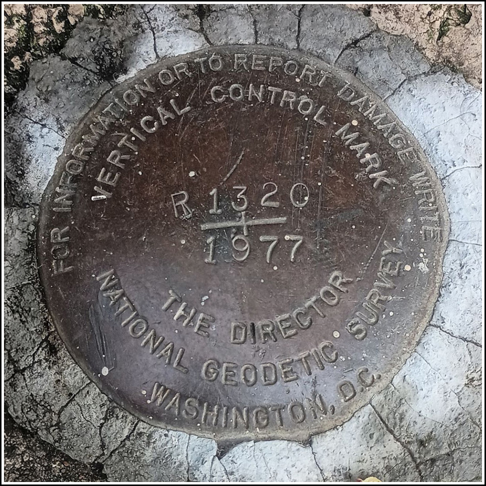
R 1320
Spatial/elevation data
| Coordinates | N 37.765583° W 122.477139° |
| Elevation | 221.39 ft. |
| Location | California
San Francisco County San Francisco North Quad |
Mark description
| Type | Vertical Control Disk |
| Setting | Pavement |
| Monumented | 1977 by NGS |
| Description (NGS) | NGS Datasheet |
Narrative and photographs
This is a guest recovery by my father Dave and his friend Lucy. After a period of rain, they were looking to get out for a walk, and Dad asked if there were any interesting benchmarks in the area. I suggested this one, R 1320, as a possibility. They walked over to Golden Gate Park on Christmas Eve and found the mark, and according to Lucy they really had fun looking for it. She said that she has walked by it thousands of times without knowing the mark was there.
The disk appears to be in good condition. The monument is slightly eroded at its edges, but the mark is still solid in its setting. This vertical control mark was part of a leveling project along the coast from San Francisco to Port San Luis, undertaken between October 1977 and May 1978.


