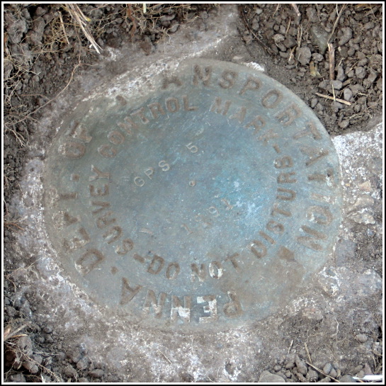
GPS 5
Spatial/elevation data
| Coordinates | N 41.459783° W 75.559283° |
| Elevation | Unknown |
| Location | Pennsylvania
Lackawanna County Olyphant Quad |
Mark description
| Type | GPS Survey Monument |
| Setting | Round Concrete Monument |
| Monumented | 1991 by PennDOT |
| Description (PennDOT) | Please see: GPS5.pdf. |
Narrative and photographs
Last Sunday, Rich and I searched for this mark on our way to claim our First Finder’s prize from “Rocks from afar.” That day, we searched for at least ten minutes with no luck before I brushed aside some dried grass clippings, dug a bit in the dirt with my shoe, and finally spotted the mark. It was at least two inches deep in the grass and dirt on this little hillside. We decided to retrieve our prize and come back another day with our tools and remote antenna to clean and document the mark. Today, though Rich was sleeping after a long night at the Mines, I returned to clean up the mark and take some photos.
The mark was set in 1991, and there have been some significant changes to the area since then. The witness post, fence, and gate are all gone. A guard rail now lines the edge of the cemetery, approximately where the fence once stood. The coordinates given on the datasheet also seemed far off; they took us to the patch of weeds south (and across the cemetery entrance road) from the mark. Counting from the curved end of the guard rail along Moosic Lake Rd., the mark can be found near the 13th vertical post. The disk is in good condition.
.")
.")


