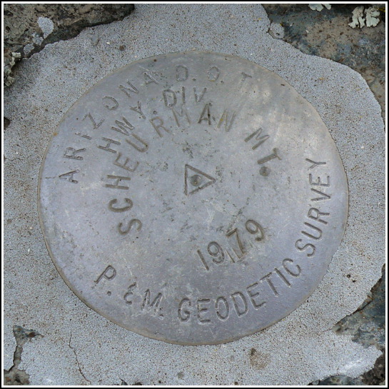
SCHEURMAN MT (ES1036)
SCHEURMAN MT
Spatial/elevation data
| Coordinates | N 34.8432° W 111.836133° |
| Elevation | 4895 ft. |
| Location | Arizona
Yavapai County Sedona Quad |
Mark description
| Type | Triangulation Station Disk |
| Setting | Rock Outcrop |
| Monumented | 1979 by AZDOT |
| Description (NGS) | NGS Datasheet |
Narrative and photographs
Crazy though we may have been, after this morning’s drenching in a wild monsoon thunderstorm at Bell Rock, Rich and I were willing to try one more hike on this weird-weather Wednesday. I’m not sure how or when we decided on Scheurman Mountain; I know we were encouraged by the relatively short length of the trail and the fact that we might have a decent chance at getting under cover should another storm hit. It would also take us close to the Red Rock Loop Road, which we wanted to explore.
By the time we reached the parking area behind the school, the sky above us was clear and the sun was strong and hot. We began organizing our packs for the hike. Water, rain shell just in case, cameras, map … datasheet … GPS? “Rich, do you have the GPS?” “Oh … no …” he responded, as he realized that it was still in our motel room.
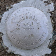
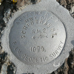
So it turned out that we had to use our car navigation GPS instead. It helped, of course, but because it’s not made for off-road travel, it wasn’t as easy as using a hiking GPS that just points you in the right direction as you move. Using the GPS to get us to the general location and then the datasheet description and box scores, we were able to locate the station and both reference marks without much trouble. Fortunately, they were all nicely exposed on bare rock outcrops!
Storms were looming, and we had gotten semi-lost on the way up, so after recovering and documenting the mark and taking in the gorgeous scenery, we headed back down the mountain.


| Designation | Status | Condition | Image |
|---|---|---|---|
| SCHEURMAN MT RM 1 | Recovered | Good |
|
| SCHEURMAN MT RM 2 | Recovered | Good |
|