TEMPE SALT R PROJECT RADIO TWR (DU2174)
TEMPE SALT R PROJECT RADIO TWR
Spatial/elevation data
| Coordinates | N 33.428254° W 111.935797° |
| Elevation | Unknown |
| Location | Arizona
Maricopa County Tempe Quad |
Mark description
| Type | Landmark/Intersection Station |
| Setting | Radio Tower |
| Monumented | 1963 by NGS |
| Description (NGS) | NGS Datasheet |
NGS recovery information
Descriptive text
Recovered in good condition.Narrative and photographs
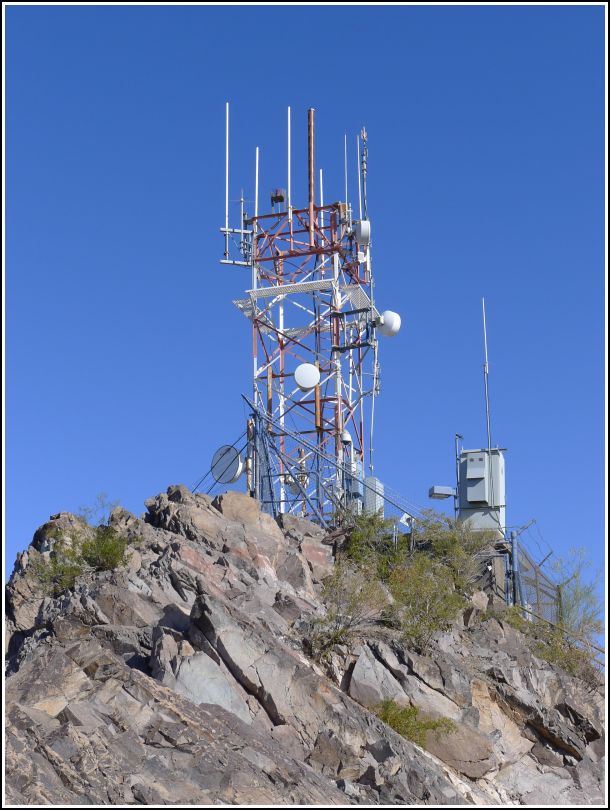
I’ve been having a lot of fun taking the train here and there in the Phoenix metro area. While the routes aren’t very extensive just yet, it has come in handy a few times and has been really cool. This morning, we took the train to Tempe Butte (also known as Hayden Butte)! The train stops right at the base of the butte, and from there a partially paved path leads to the top. We’re not typically that interested in paved walkways, but the tower at the top is a landmark station that also supposedly has a tri-station at its base, so we thought it would be fun to combine the activities and check out the butte.
It was a very hot morning, but cool in the shade, and the walk up the butte was an easy one. It’s a popular path, but it wasn’t too busy early this morning. We could see the tower from the bottom. The area right around the tower was precarious, though! It was almost impossible to maneuver around to see if the tri-station was in place: sheer dropoffs bordered the entire base of the fence surrounding the tower. I looked the best I could anyway, even using our scope, but I couldn’t spot a single disk of the set, not even any of the RMs. We would have to settle for the tower!
Edit (November 2020): While researching the Salt River Project I came across a statement on Wikipedia indicating that in May 2019 “all towers and related materials were removed permanently by the city of Tempe.”