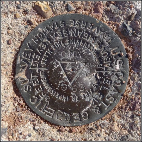
GUN (DU0876)
GUN
Spatial/elevation data
| Coordinates | N 33.461713° W 111.952192° |
| Elevation | 1317.13 ft. |
| Location | Arizona
Maricopa County Tempe Quad |
Mark description
| Type | Traverse Station Disk |
| Setting | Round Concrete Monument |
| Monumented | 1963 by NGS |
| Description (NGS) | NGS Datasheet |
NGS recovery information
Descriptive text
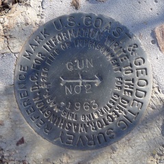
The station and RM 2 were recovered in good condition. RM 1 was not found. Handheld GPS coordinates for RM 2 are 33 27 42.4(N) 111 57 08.2(W).Narrative and photographs
We spent part of today exploring the Phoenix Zoo and Papago Park. Of course, one of the reasons we wanted to explore the park was to search for a few benchmarks! GUN sounded interesting and we were able to locate the station disk without any difficulty. It’s a little beat-up, but the monument is still in good shape and easy to spot in the open desert landscape. RM 2 is embedded in a small rock; it is in good condition as well, and we had no trouble locating it using the coordinates and historical description. Unfortunately, RM 1 was a different story. We found a possible drill hole in a rock at the approximate distance and direction noted in the previous recovery, but it wasn’t enough for us to say whether it truly had been the site of the reference mark. In any case, nothing is left and it is certainly not usable.


| Designation | Status | Condition | Image |
|---|---|---|---|
| GUN RM 1 | Not Found | Unknown (Not Found) |

|
| GUN RM 2 | Recovered | Good |
|