P 37
Recovered in Good Condition on March 26, 2019
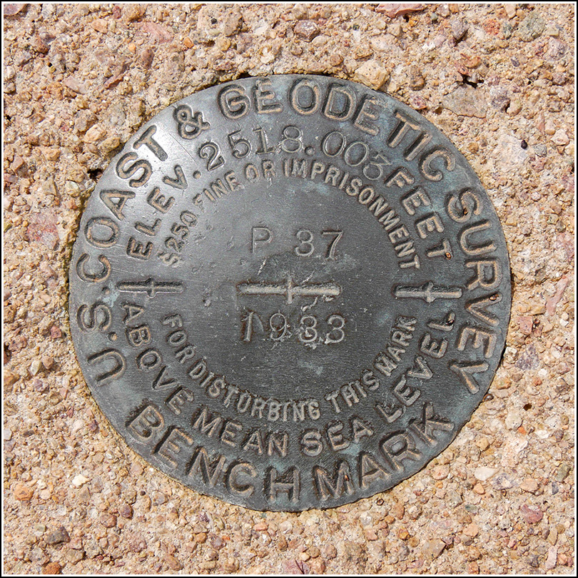
Spatial/elevation data
| Coordinates | N 32.1666° W 112.126664° |
| Elevation | 2520.2 ft. |
| Location | Arizona
Pima County Maish Vaya Quad |
Mark description
| Type | Bench Mark Disk |
| Setting | Square Concrete Monument |
| Monumented | 1933 by NGS |
| Description (NGS) | NGS Datasheet |
NGS recovery information
Descriptive text
Recovered in good condition.Narrative and photographs
This standard benchmark disk also served as a reference mark (RM 2) for the nearby triangulation station COVERED, which is located on the opposite (north) side of Route 86. It is set in a concrete monument that projects about 6 inches above the ground, so it was very easy to spot. The disk is in excellent condition.

