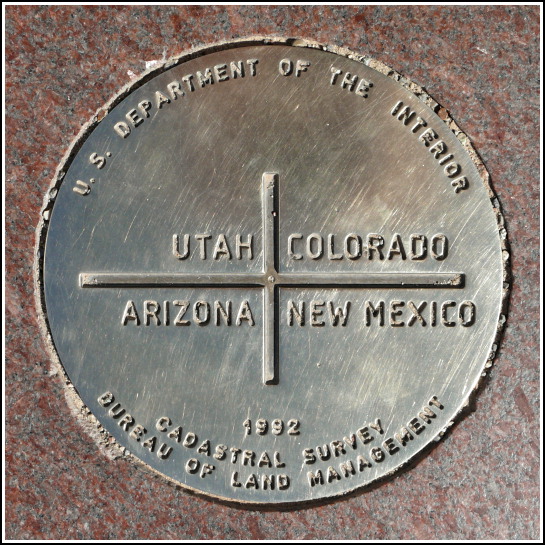
CO UT AZ NM (AD9256)
CO UT AZ NM
Recovered in Good Condition on September 14, 2008
Spatial/elevation data
| Coordinates | N 36.998983° W 109.045167° |
| Elevation | 4866 ft. |
| Location | Colorado
Montezuma County Teec Nos Pos Quad |
Mark description
| Type | Boundary Monument |
| Setting | Stone Slab |
| Monumented | 1992 by Bureau of Land Management |
| Description (NGS) | NGS Datasheet |
Narrative and photographs
This is one big benchmark disk! It’s also one of the best-known, because probably hundreds of people per week visit the Four Corners just to stand on this spot. In 1992, the original Four Corners monument (FOUR CORNERS=GLO STA 1) was destroyed and it was replaced with this large (8-inch diameter) disk. An elaborate stone platform surrounds the disk. The land is owned by the Navajo Nation, and there’s typically a variety of stands set up around the monument platform where the Navajo people sell arts & crafts and food items (I wholeheartedly recommend the fry bread with honey!).

