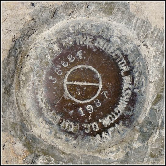
872 3868 F TIDAL
Recovered in Good Condition on February 18, 2014
Spatial/elevation data
| Coordinates | N 24.84495° W 80.748117° |
| Elevation | 7.53 ft. |
| Location | Florida
Monroe County Lower Matecumbe Key Quad |
Mark description
| Type | Tidal Bench Mark Disk |
| Setting | Bridge Wingwall |
| Monumented | 1987 by Florida Dept. of Natural Resources |
| Description (NGS) | NGS Datasheet |
NGS recovery information
Descriptive text
Recovered in good condition. Handheld GPS coordinates for the bench mark are 24 50 41.8(N) 080 44 53.2(W).Narrative and photographs
This was the second of two benchmarks we found at the northeastern end of the old bridge over Channel #2. This mark is set on the wingwall, down a few meters from the top. The disk is corroded but the stamping is still in excellent condition and it is solid in its setting.

