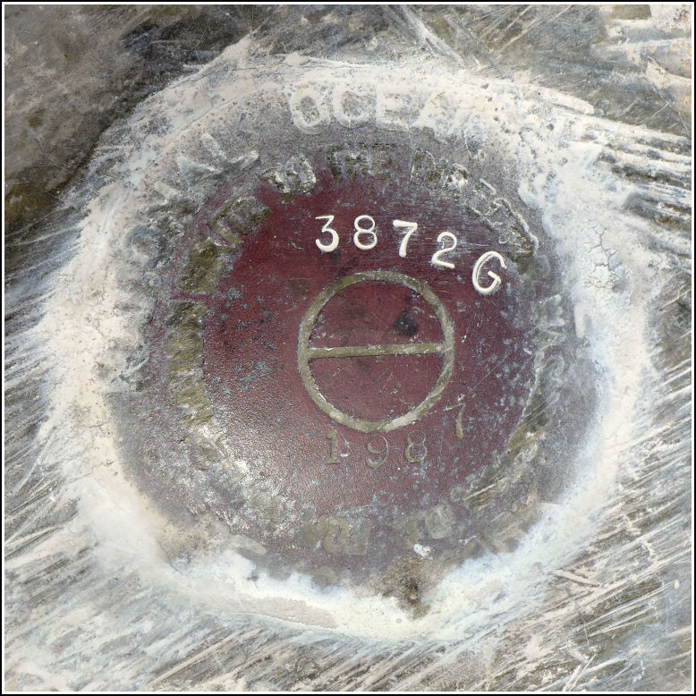
872 3872 G TIDAL (AA1727)
872 3872 G TIDAL
Spatial/elevation data
| Coordinates | N 24.839581° W 80.779939° |
| Elevation | 14.51 ft. |
| Location | Florida
Monroe County Long Key Quad |
Mark description
| Type | Tidal Bench Mark Disk |
| Setting | Bridge Wingwall |
| Monumented | 1987 by National Ocean Service |
| Description (NGS) | NGS Datasheet |
NGS recovery information
Descriptive text
Recovered in good condition. The disk is stamped with the designation 3872 G and the date 1987. It is located on the southwest wingwall at the western end of the old bridge over Channel Five, which is now a fishing pier. The current U.S. Route 1 bridge is directly south of the old bridge.Narrative and photographs
One of this afternoon’s activities was a hike at Long Key State Park’s Layton Trail, a short but eerily beautiful walk north to the bay from Route 1. We entertained the idea of hiking the Golden Orb Trail in the other part of the state park, but decided that we wanted to spend more time there than we had left in our afternoon. So instead, we took a leisurely drive back up Route 1 and stopped at two fishing piers along the way in search of benchmarks. These fishing piers are sections of the original Route 1 that have been repurposed for fishing and as part of the Florida Overseas Highway Trail.
The first one we found was 872 3872 G TIDAL. It is located in the southwest wingwall at the western end of the old highway bridge over Channel 5. It is in good condition.

