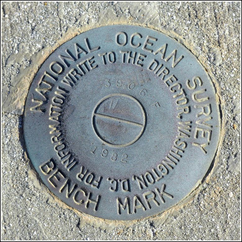
872 3706 F TIDAL (AA1720)
872 3706 F TIDAL
Spatial/elevation data
| Coordinates | N 24.791064° W 80.884452° |
| Elevation | 19.79 ft. |
| Location | Florida
Monroe County Grassy Key Quad |
Mark description
| Type | Tidal Bench Mark Disk |
| Setting | Concrete Bridge Sidewall |
| Monumented | 1982 by Florida Dept. of Natural Resources |
| Description (NGS) | NGS Datasheet |
NGS recovery information
Descriptive text
Recovered in good condition on the highway bridge over Long Key Channel, as described. Note: the designation is recorded in the database as 3706 F but the disk is stamped 3906 F.Narrative and photographs
To round out our Long Key benchmark blitz, we stopped at the western end of the Long Key Viaduct to see what we might find. And as is almost expected in the Keys, we found several marks. The first was 872 3706 F TIDAL, which scared me a bit as it is located on the railing of the new highway bridge (think dozens of crazy Florida drivers flying by!) and Rich climbed up and over to get a photo of the disk. He was able to take the photo quickly and return to the safety (with the exception of a few fire ants) of the area between the old and new bridges. The disk is in good condition with legible stamping (3906) that differs from the mark’s designation in the database (3706). It seems that the discrepancy is known because the difference between the designation and stamping is noted on the datasheet. However I’m pretty sure that NGS’s policy is not to change the given designation even when it appears to be a typo; they simply note the true stamping in the proper field.

