WEST BAHIA 1935 (AA1509)
WEST BAHIA 1935
Not Found as of February 24, 2014
Spatial/elevation data
| Coordinates | N 24.654689° W 81.281582° |
| Elevation | 3 ft. |
| Location | Florida
Monroe County Big Pine Key Quad |
Mark description
| Type | Triangulation Station Disk |
| Setting | Square Concrete Monument |
| Monumented | 1935 by NGS |
| Description (NGS) | NGS Datasheet |
Narrative and photographs
We certainly didn’t have any hopes of finding this station—it was last seen in 1937 and has been presumed destroyed or covered under fill since 1954. But we still put it on our list to investigate the area and look for any remaining reference marks. When we arrived at Bahia Honda State Park this morning we headed first toward the old railroad bridge, the eastern end of which is now a viewing platform over the ocean. As expected, we did not find the station disk or RM 1 (which was also not recovered since before 1954). But we were able to find RM 2 on the south wingwall of the bridge. It is in good condition and was easy to access.
| Designation | Status | Condition | Image |
|---|---|---|---|
| WEST BAHIA RM 1 | Not Found | Destroyed |

|
| WEST BAHIA RM 2 | Recovered | Good |
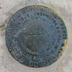
|