872 4557 TIDAL 2
Recovered in Good Condition on February 23, 2014
Spatial/elevation data
| Coordinates | N 24.546316° W 81.783733° |
| Elevation | 2.64 ft. |
| Location | Florida
Monroe County Key West Quad |
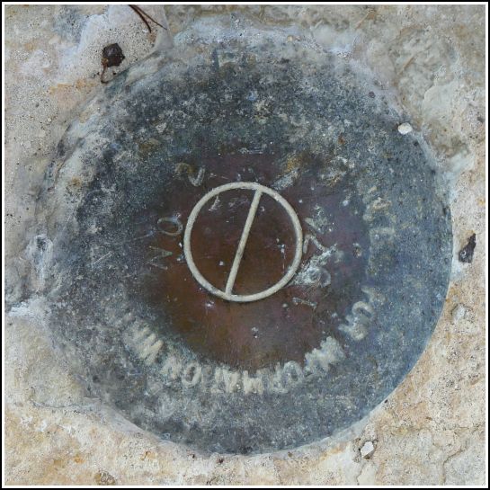
Mark description
| Type | Tidal Bench Mark Disk |
| Setting | Concrete Sidewalk |
| Monumented | 1974 by National Ocean Service |
| Description (NGS) | NGS Datasheet |
NGS recovery information
Descriptive text
Recovered in good condition. The light poles have changed. The disk is northeast of the fifth light pole, counting from the north end of the pier.Narrative and photographs
We found this disk easily while on our benchmark hunt along the White Street Pier. The original NGS description refers to light poles, which have changed since 1982, when that description was written. The disk is now northeast of the fifth light pole from the north end of the pier. The disk shows some corrosion, but the designation and date are still easily legible.


