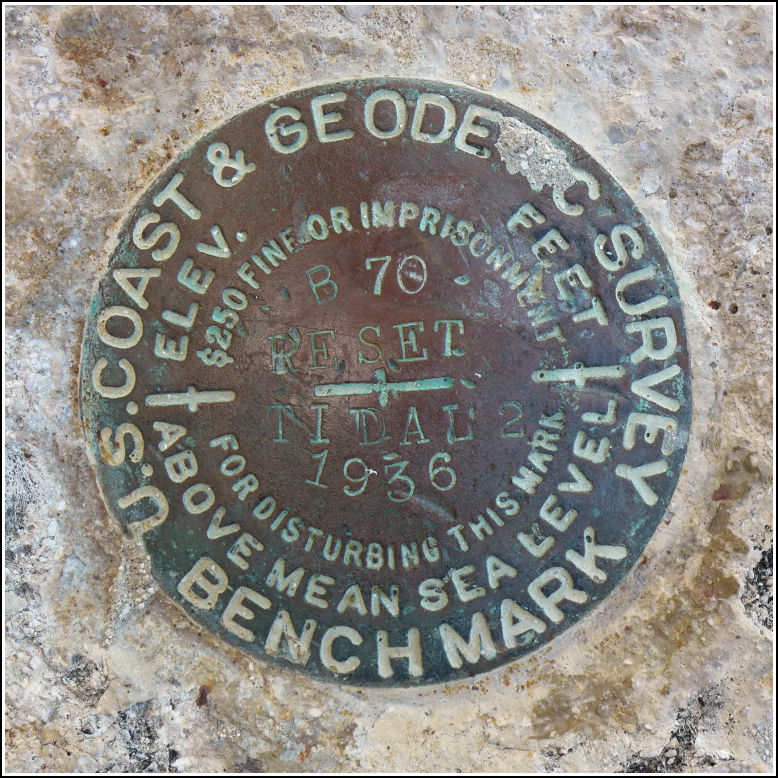
B 70 RESET (AA0281)
B 70 RESET
Recovered in Good Condition on February 18, 2016
Spatial/elevation data
| Coordinates | N 24.68253° W 81.22838° |
| Elevation | 15.83 ft. |
| Location | Florida
Monroe County Sevenmile Bridge Quad |
Mark description
| Type | Bench Mark Disk |
| Setting | Bridge Wingwall |
| Monumented | 1936 by NGS |
| Description (NGS) | NGS Datasheet |
NGS recovery information
Descriptive text
Recovered in good condition on the north wingwall at the west end of the old seven mile bridge. This section of the former bridge is now a fishing pier and part of a recreational trail. The current Seven Mile Bridge is directly south of the old bridge.Narrative and photographs
B 70 RESET was part of the “benchmark bonanza” we stumbled upon at the western end of the old Seven Mile Bridge. There are four marks at this end of the bridge, two within less than a foot of each other (DUCK 2 and B 70 RESET). The mark is set at the extreme top of the northern wingwall of the old bridge, the western end of which is now used as a fishing pier. The benchmark is in good condition.
