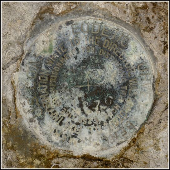
N 328 (AA0216)
N 328
Spatial/elevation data
| Coordinates | N 24.727183° W 81.388067° |
| Elevation | 0.84 ft. |
| Location | Florida
Monroe County Summerland Key Quad |
Mark description
| Type | Bench Mark Disk |
| Setting | Rock Outcrop |
| Monumented | 1970 by NGS |
| Description (NGS) | NGS Datasheet |
NGS recovery information
Descriptive text
Recovered in good condition. Stamping is worn but legible. The mark is at the northern end of Bryant Avenue/Key Deer Boulevard, an entryway into the National Key Deer Refuge. The drainage ditches are overgrown but still evident.Narrative and photographs
The first mark we had in mind for our morning at the Key Deer Refuge was supposed to be in/near a “mosquito drainage ditch” which in its current overgrown state is even less impressive than it sounds. But actually, it’s quite cool how these channels were carved into the rock. This network of ditches drains the mosquito habitat in an attempt to control the population by providing channels to freely introduce fish, which feed on the insect larvae, to the area. We had quite a time getting to this mark in the overgrowth, and maneuvering in order to take a decent photo was also challenging. It took a few tries going back out to the road and looking for a likely spot before we zeroed in on the mark. The disk is in good condition and solidly set, although it is worn or corroded, making the stamping somewhat difficult to discern.

