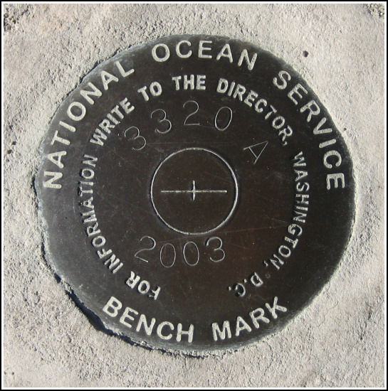
841 3320 TIDAL A
841 3320 TIDAL A
Recovered in Good Condition on September 13, 2007
Spatial/elevation data
| Coordinates | N 44.391183° W 68.20565° |
| Elevation | Unknown |
| Location | Maine
Hancock County Bar Harbor Quad |
Mark description
| Type | Tidal Bench Mark Disk |
| Setting | Concrete Berm |
| Monumented | 2003 by National Ocean Service |
| Description (National Ocean Service) | The bench mark is a disk set in the concrete bulkhead located on the north side of West Street, 12.50 m (41.0 ft) NNW of the centerline of West Street, 9.60 m (31.5 ft) NE of power pole 3S located on the north side of West Street, 8.11 m (26.6 ft) ENE of the NW corner of the concrete bulkhead, and 0.24 m (0.8 ft) SSE of the northern edge of the concrete seawall. From: NOS Tides and Currents |
Narrative and photographs
After our touristy-but-fun sailing on the Margaret Todd, Rich and I wandered around the pier; I had a sneaking suspicion that some of the other new NOS marks would be nearby, perhaps on the other side of the main building at the municipal pier (the one that houses the Fish House Grill), which is an area we had never checked before. This was the first of the two marks that we spotted. It is set into the middle of the concrete berm a hundred feet or so to the southwest of the second mark (TIDAL F), on a promenade area between Stewman’s and the Fish House Grill. This new disk is in very good condition.

