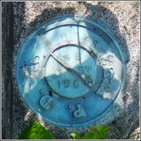
48 DSW
48 DSW
Spatial/elevation data
| Coordinates | N 41.513027° W 75.2944549° |
| Elevation | 1156.930 ft. |
| Location | Pennsylvania
Wayne County Honesdale Quad |
Mark description
| Type | Elevation Mark |
| Setting | Bridge Wingwall |
| Monumented | 1963 by USGS |
| Description (USGS) | Gravity, about 6.0 mi NE. of, along dirt rd. leading to State Highway 191; 13 ft. N. of, and about level with centerline of rd. opposite; in NE. corner of N. wingwall of concrete bridge over Collins Brook; PDH standard disk stamped “48 DSW 1963 USGS” |
Narrative and photographs
48 DSW was an unplanned find. The next mark on our list after TT 9 J was TT 8 J, along Tannery Road. We were interested to see if Middle Creek Road truly does connect all the way through to Tannery Road; our Garmin nüvi was showing that it does and routing us that way, while Google Maps shows a gap of approximately ¾ mile. (It turns out Google Maps is wrong. Middle Creek Road does connect through to Mill Brook Road and then Tannery Road.)
Rich suggested that I check the bridges along the way, and I was thrilled to find 48 DSW on the northeast wingwall of this bridge! I was not thrilled, however, at the copious amount of poison ivy thickly surrounding the bridge on both sides. I didn’t even attempt to get close to the mark, which had a poison ivy leaf hanging over it; I simply photographed it from above. The disk is in good condition and the description is accurate, except that Middle Creek Road is now paved.
 on the bridge wingwall.")

