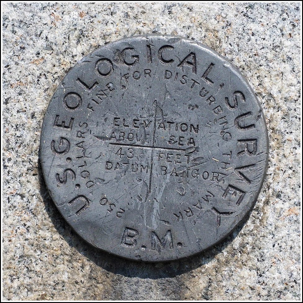
43 BANGOR 1899
43 BANGOR 1899
Spatial/elevation data
| Coordinates | N 44.57148° W 68.791938° |
| Elevation | 43.470 ft. |
| Location | Maine
Hancock County Bucksport Quad |
Mark description
| Type | Bench Mark Disk |
| Setting | Stone Step |
| Monumented | 1899 by USGS |
| Description (USGS) | Bucksport, on lowest step of side wall on left side of stone steps to Buck Memorial Library, in front face of coping; aluminum tablet stamped “43 Bangor 1899” |
Narrative and photographs
Although we were exhausted this morning and didn’t plan to spend much time in Bucksport, we just had to stop at the library to look for this very old benchmark. It was intriguing not only because of its location and age, but also because we were right here last year but weren’t aware of this benchmark at the time. It wasn’t until we got home last year that I spotted the BM on the topo map right in the heart of Bucksport.
Rich parked on the street in front of the library, and I walked right up to the mark, exactly as described on the stone steps leading up to the library from the sidewalk. The mark is set vertically, so it’s obvious even from the road (I am, again, surprised we didn’t spot it last year just driving by). The disk is in good condition.

