3062.26
3062.26
Recovered in Good Condition on May 27, 2011
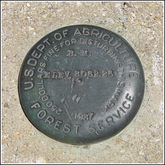
Spatial/elevation data
| Coordinates | N 32.177233° W 110.738016° |
| Elevation | 3062.26 ft. (est.) |
| Location | Arizona
Pima County Tanque Verde Peak Quad |
Mark description
| Type | Bench Mark Disk |
| Setting | Square Concrete Monument |
| Monumented | 1937 by U. S. Forest Service |
| Description (U. S. Forest Service) | Unavailable. |
Narrative and photographs
Just like the nearby tri-station POST, this is a mark we weren’t prepared for but happened to spot on our map. This one was signified by a simple BM and an “x”, plus the elevation, so we had no idea what type of mark it might be. We were fortunate that it was very easy to find in the location we had estimated from the map, and we were happy to see that it was something a little different—a U.S. Forest Service disk! We don’t have a source for descriptions for Forest Service marks, so we aren’t able to provide any official updates, but it was still a very neat find.


