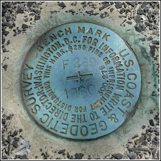
F 269 (KV1659)
F 269
Spatial/elevation data
| Coordinates | N 40.622316° W 75.3844° |
| Elevation | 299.58 ft. |
| Location | Pennsylvania
Northampton County Allentown East Quad |
Mark description
| Type | Bench Mark Disk |
| Setting | Bridge Bannister |
| Monumented | 1960 by NGS |
| Description (NGS) | NGS Datasheet |
NGS recovery information
Descriptive text
Recovered in good condition. Handheld GPS coordinates for the mark are 40 37 20.3(N) 075 23 03.8(W).Narrative and photographs
This was a very simple find after our successful recovery of BETH (KV3603) several blocks away. Rich and I were exploring the streets of Bethlehem, waiting until we were hungry enough for an early supper at the Bethlehem Brew Works (at the eastern end of the W. Broad Street bridge). Why, what a surprise—there’s a benchmark at the west end of the bridge! Of course I knew about it beforehand, and had the datasheet stored in my phone for easy access. We found it easily after a hurried walk across the bridge on this sunny but extremely windy day. The marker is in good condition and the description is accurate.
I was intrigued by the view of what appeared to be a park far below the bridge, alongside the Monocacy Creek. Just a few minutes later, while continuing our explorations of town, we found our way down to the park and and “colonial industrial quarter” that the town is attempting to restore. We saw the remnants of an old mill, textile dye house, waterworks, and several crumbling walls that gave no clue to their former use. Restoration of the blacksmith shop is complete. We enjoyed listening to the blacksmith’s tales as he pounded out nails the old fashioned way.
 on top of bridge bannister. The bridge builders’ plate is below, but the bridge number is not indicated.")


