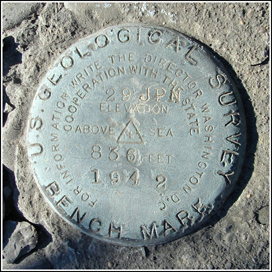
29 JPN
29 JPN
Recovered in Good Condition on April 5, 2005
Spatial/elevation data
| Coordinates | N 41.413233° W 75.705333° |
| Elevation | 836.487 ft. |
| Location | Pennsylvania
Lackawanna County Scranton Quad |
Mark description
| Type | Bench Mark Disk |
| Setting | Masonry Bridge Headwall |
| Monumented | 1942 by USGS |
| Description (USGS) | Scranton; at city line on S. Keyser Avenue; 240 ft N. of T-rd. W. to Milwaukee; on E. headwall of small masonry bridge over creek; standard tablet stamped “29 JPN 1942 836”. Elev. 836.487 ft. |
USGS recovery information
View reportNarrative and photographs
We found this mark on our way home from a messy encounter with Skipsp’s geocache A View of the Park at nearby McDade Park. The lot of the Open Door Baptist Church on Keyser Avenue was a convenient spot to park as it’s just south of the bridge. We could see the mark from across the street. The mark is in good condition and seems solid in its setting, though the concrete layer atop the masonry headwall is deteriorating. The stamping is clear and the disk appears almost untouched—unusual for a mark in such an exposed, public location.

