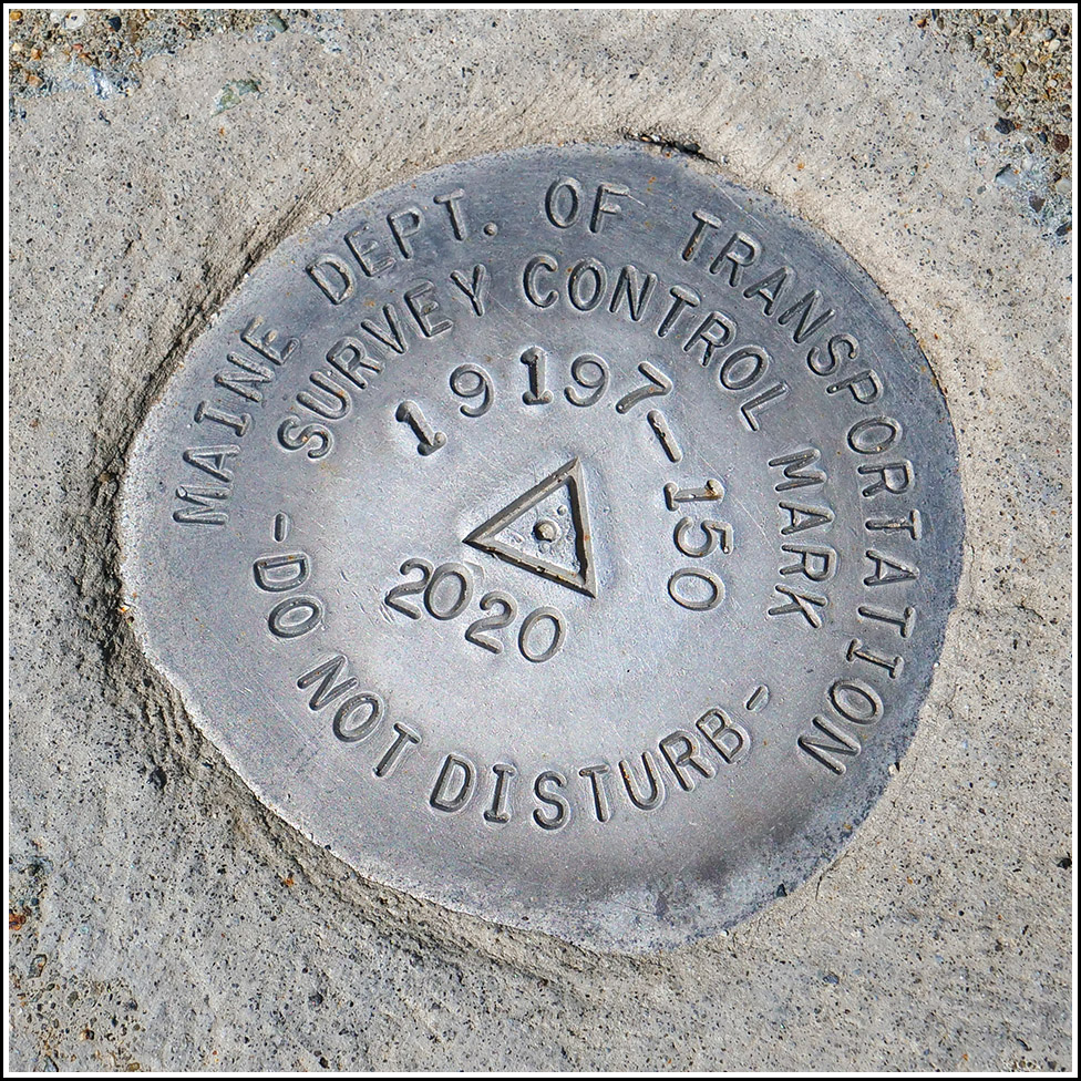
19197-150
Recovered in Good Condition on September 11, 2021
Spatial/elevation data
| Coordinates | N 44.38625° W 68.211416° |
| Elevation | 77.487 ft. |
| Location | Maine
Hancock County Bar Harbor Quad |
Mark description
| Type | Survey Control Mark |
| Setting | Concrete Sidewalk |
| Monumented | 2020 by MaineDOT |
| Description (MaineDOT) | To reach from the junction of Rte. 233 (Eagle Lake Rd) and Rte. 3 (Mt Desert St) in the town of Bar Harbor travel E on Rte. 3 for 0.1 miles to the station on the left. The station is an aluminum disk stamped 19197-150 2020 and is set in concrete side walk. It is 21 ft. N of center line of Rte. 3, 11 ft. E of hydrant, 30 ft. W on center line of Holland Ave. BK# 402 |
Narrative and photographs
While walking back from a morning’s worth of activities at Sieur de Monts, we spotted this brand-new MaineDOT survey marker from 2020 embedded in the sidewalk along Mount Desert Street. It is directly south of the Island Place motel and a few feet north of the north curb of Mount Desert Street.

