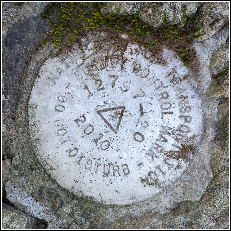
12797-20
Spatial/elevation data
| Coordinates | N 44.420211° W 68.362718° |
| Elevation | 36.791 ft. |
| Location | Maine
Hancock County Salsbury Cove Quad |
Mark description
| Type | Survey Control Mark |
| Setting | Rock Ledge |
| Monumented | 2010 by MaineDOT |
| Description (MaineDOT) | The station is located from the junction of Rte 3 and Rte’s 102 & 198(Main St), head S on main St. for 0.85mi to the station on the right. The station is a disk stamped…12797-20 2010…set in concrete in ledge. IT IS: 28.0’ W of CL; 58.2’ S of CB center; 15.4’ E of FWP with MWS attached. BK#373 |
Narrative and photographs
We were pretty sure that if we could access this area, we’d have a two-fer: not only this mark, but also the USGS mark K 3 very close by. As usual, we had scoped out the area on Street View and had a good idea where to search. We had even spotted on Street View, through the pixellated brush, a survey mark witness post, so we were even more sure we had the right spot. We parked in an empty lot very close to the coordinates and made our way through the prickly brush and conifers. Spotting the witness post easily, we began to look around for the marks. The first one we spotted, on a nicely exposed section of an outcrop, was this mark, the MaineDOT survey control mark. We cleaned it off and documented it with photos, and then moved on to search for K 3, just a few meters away.
")
