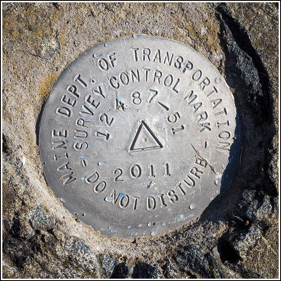
12487-51
Recovered in Good Condition on September 11, 2025
Spatial/elevation data
| Coordinates | N 44.415913° W 68.250793° |
| Elevation | Unknown |
| Location | Maine
Hancock County Salsbury Cove Quad |
Mark description
| Type | Survey Control Mark |
| Setting | Rock Outcrop |
| Monumented | 2011 by MaineDOT |
| Description (MaineDOT) | To Reach the station from the jct of Rte 3 and Rte 198 in Bar Harbor head South Easterly on Rte 3 for 7.12 Mi to the station on the left, across from the Colony Motel. The station is a disk stamped—12487-51 2011—set in concrete in a ledge outcrop. IT IS: 76.0’ E of CL; 53.0’ NE of Apple tree. BK#376 |
Narrative and photographs
Our first mark of the day is a mere 13 meters from a USGS mark we found back in 2007. This one, a MaineDOT survey control disk, was set in 2011, so it wasn’t even here the last time we visited this ledge. I just love this area. Although it is literally a few feet away from the highway, something about it feels so peaceful and serene. I would love to sit here and read, or have a snack in the sunshine. Anyway, we found the mark easily, and then confirmed that K 10 (the USGS mark) is still in place (it is).


")