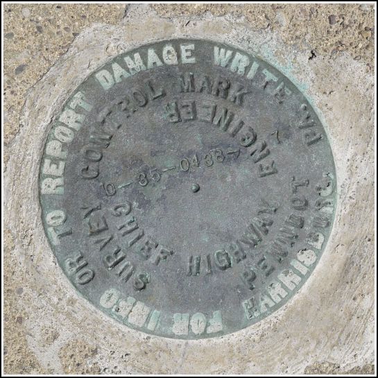
10-35-0438-7
10-35-0438-7
Recovered in Good Condition on June 30, 2012
Spatial/elevation data
| Coordinates | N 41.574966° W 75.641867° |
| Elevation | Unknown |
| Location | Pennsylvania
Lackawanna County Dalton Quad |
Mark description
| Type | Survey Control Mark |
| Setting | Concrete bridge headwall |
| Monumented | Unknown by PennDOT |
| Description (PennDOT) | Unavailable. |
Narrative and photographs
There are several fairly new PennDOT survey marks placed in bridges along PA Route 438 (Montdale Road). They’re a relatively short walk from home and we had some fun exploring and recovering them today. This disk is set into the southeast corner of the bridge headwall, and it is in good condition. The bridge crosses over the South Branch of Tunkhannock Creek.


