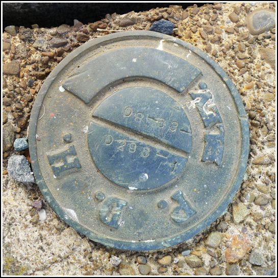
08-63-0296-1
08-63-0296-1
Spatial/elevation data
| Coordinates | N 41.58164° W 75.40826° |
| Elevation | Unknown |
| Location | Pennsylvania
Wayne County Waymart Quad |
Mark description
| Type | Elevation Mark |
| Setting | Bridge Wingwall |
| Monumented | 2008? by PennDOT |
| Description (PennDOT) | Unavailable. |
Narrative and photographs
Rich and I found this PDH disk after attending an awesome presentation of “A Ride on the D&H Gravity Railroad: Honesdale to Carbondale” by John Revak at the Waymart Area Historical Society. Dad met us at the gravity museum depot, which he has never seen before. Everyone at the historical society was pleased that more than 30 people attended, since audience numbers for similar presentations had been so inconsistent in the past (swinging from over 30 to only two). Seeing the old photographs emphasized to me how it’s a minor miracle that we can find any of these marks since so much has changed in, really, very little time.
On our way to the museum, we passed over this small, obviously old bridge along Route 296. I expected that there might be an old PDH mark set on it somewhere. After the presentation and a late lunch at Waymart Hotel (where else?!) Rich and I stopped to check the wingwalls of the bridge. And there it was, on the southeast wingwall (and the first one we checked): a PDH disk, rather recently stamped by PennDOT. Of course, no description or elevation data is available (to us, anyway), but it’s still worth cataloging our find.

.")