TT 27 T
TT 27 T
Spatial/elevation data
| Coordinates | N 41.61278° W 75.55811° (estimate) |
| Elevation | 1669.805 ft. |
| Location | Pennsylvania
Lackawanna County Carbondale Quad |
Mark description
| Type | Transit Traverse Station Disk | ||||||
| Setting | Concrete Post | ||||||
| Monumented | 1932 by USGS | ||||||
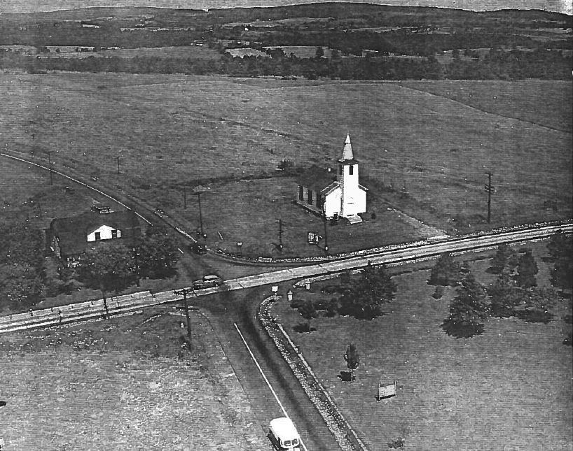
| Description (USGS) | Dundaff, 2.5 mi S. of; 74 ft due E. of intersection of State Highway 147 and U.S. Highway 106; in frontyard of Finch Hill Church; in concrete post; standard tablet stamped “TT 27 T 1932”
|
Narrative and photographs
Rich and I have looked for this mark a few times without any success. Today we came back with our metal detector, hoping that we could at least positively identify its location, if not actually dig up the church yard and fully recover the disk. A groundskeeper was mowing the grass. Great! we thought; if there’s still a monument here, he must know about it. But he had never seen any such monument. He did explain that he was pretty sure the front yard of the church had been regraded at some point.
The description doesn’t give any dimensions or distances from the church, and the roads have probably been widened in the meantime, so we really don’t know for sure where the mark was located. PennPilot imagery and an image of the church taken from their website are also less than helpful. We searched the entire front and side yard of the church by eye and with the metal detector without any luck. The mark is either gone or buried, with little hope for future recovery and use.
Connected to Finch Hill Corners is this nostalgic, endearing and rather bizarre bit of folklore: Finch Hill Corners, the 4 Corners of Life. It was new to me, but Rich remembers hearing the tale when he was younger.