08-63-0006-3
08-63-0006-3
Spatial/elevation data
| Coordinates | N 41.56861° W 75.25237° |
| Elevation | Unknown |
| Location | Pennsylvania
Wayne County Honesdale Quad |
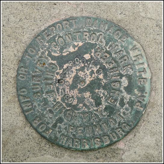
Mark description
| Type | Survey Control Mark |
| Setting | Bridge Bannister |
| Monumented | 2008? by PennDOT |
| Description (PennDOT) | Unavailable |
Narrative and photographs
After spending over an hour exploring the nearby Wayne County Historical Society museum, Rich and I took a walk to the south side of Honesdale in search of an NGS benchmark, I (LY1069). We had no real expectations of finding the mark because our research using Google Street View indicated that the bridge had undergone some serious renovation in 2009.
We were correct that LY1069 is gone or at least inaccessible, having been removed or perhaps covered over when the bridge was widened. We did, however, find this relatively new PennDOT survey control mark near the site of the old NGS benchmark. The mark is set into the south concrete parapet at the west end of the 4th Street bridge in Honesdale, and it is in good condition with legible stamping.

