JOHN BROWNS GRAVE RM 2
Recovered in Good Condition on August 6, 2006
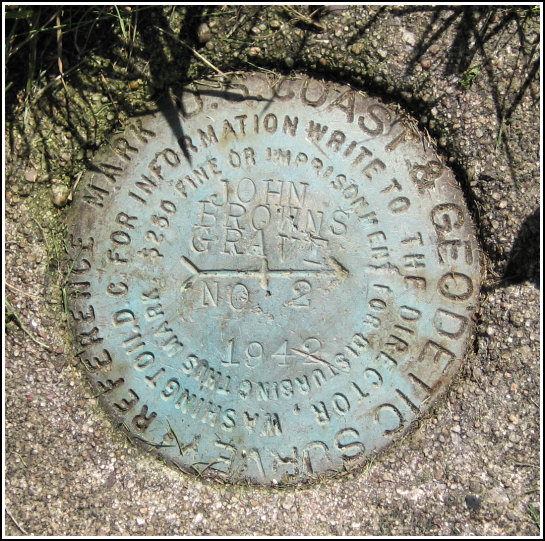
Spatial/elevation data
| Coordinates | N 44.2523° W 73.971033° |
| Elevation | 1857.16 ft. |
| Location | New York
Essex County Lake Placid Quad |
Mark description
| Type | Reference Mark Disk |
| Setting | Square Concrete Monument |
| Monumented | 1942 by NGS |
| Description (NGS) | NGS Datasheet |
NGS recovery information
Descriptive text
Recovered in good condition as described. Autonomous (non-corrected) handheld GPS coordinates are 44 15 08.3(N) 073 58 15.7(W).Narrative and photographs
For more information about this reference mark, see its parent mark JOHN BROWNS GRAVE.
Rich and I recovered this reference mark as part of our recovery of PG0932, the JOHN BROWNS GRAVE tri-station. RM 2 is in good condition.


