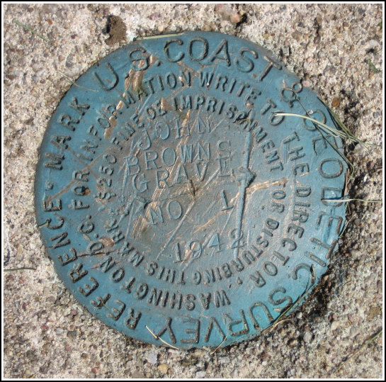
JOHN BROWNS GRAVE RM 1
Recovered in Good Condition on August 6, 2006
Spatial/elevation data
| Coordinates | N 44.252717° W 73.971° |
| Elevation | 1857.87 ft. |
| Location | New York
Essex County Lake Placid Quad |
Mark description
| Type | Reference Mark Disk |
| Setting | Square Concrete Monument |
| Monumented | 1942 by NGS |
| Description (NGS) | NGS Datasheet |
NGS recovery information
Descriptive text
Recovered as described in the 1975 and 1994 recoveries.Narrative and photographs
For more information about this reference mark, see its parent mark JOHN BROWNS GRAVE.
Rich and I recovered this reference mark as part of our recovery of PG0932, the JOHN BROWNS GRAVE tri-station. RM 1 is in good condition and has been resurveyed as a GPS station.


