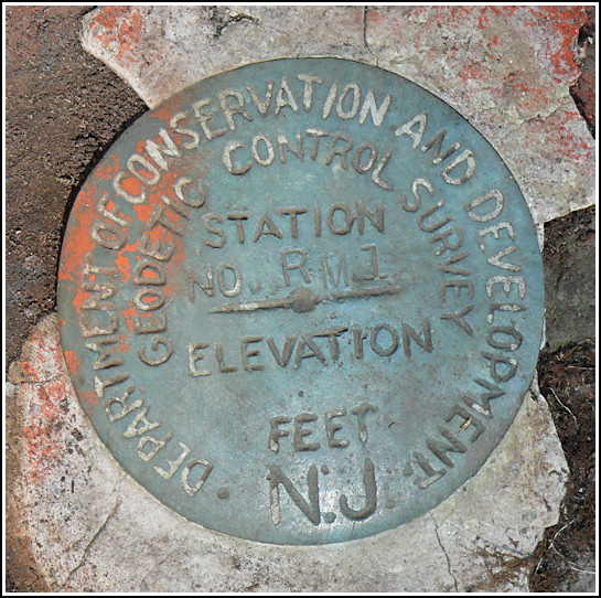
GIRR RM 1
Recovered in Good Condition on April 19, 2008
Previous attempt (April
10, 2007)
Spatial/elevation data
| Coordinates | N 41.119283° W 74.945283° |
| Elevation | Unknown |
| Location | New Jersey
Sussex County Flatbrookville Quad |
Mark description
| Type | Reference Mark Disk |
| Setting | Rock Outcrop |
| Monumented | 1938 by New Jersey Division of Conservation and Development |
Narrative and photographs
For more information about this reference mark, see its parent mark GIRR.


