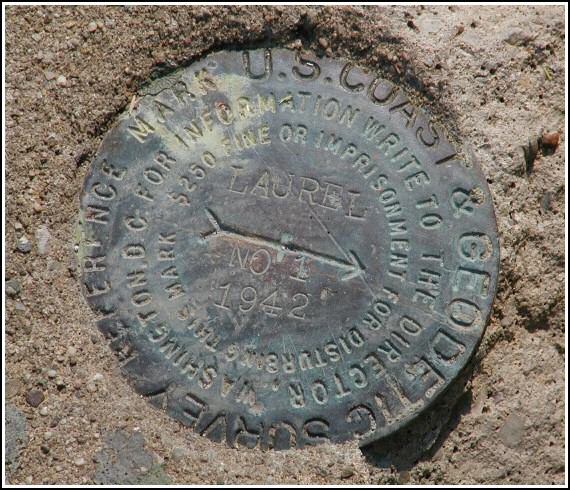
LAUREL RM 1
Recovered in Good Condition on November 3, 2002
Spatial/elevation data
| Coordinates | N 41.357516° W 74.6944° |
| Elevation | Unknown |
| Location | New York
Orange County Port Jervis South Quad |
Mark description
| Type | Reference Mark Disk |
| Setting | Square Concrete Monument |
| Monumented | 1942 by NGS |
Narrative and photographs
For more information about this reference mark, see its parent mark LAUREL.
Zhanna located this mark while searching for triangulation station LAUREL (LY2611) but does not have any photos.
(Recovered on June 27, 2003)


