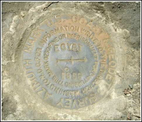
EGYPT AZ MK (LY1167)
Recovered in Good Condition on July 10, 2004
Spatial/elevation data
| Coordinates | N 41.341383° W 75.2082° |
| Elevation | 1768.95 ft. |
| Location | Pennsylvania
Pike County Promised Land Quad |
Mark description
| Type | Azimuth Mark Disk |
| Setting | Boulder |
| Monumented | 1959 by NGS |
| Description (NGS) | NGS Datasheet |
NGS recovery information
Descriptive text
Recovered in good condition. The mark is on the west side of Route 390, directly across the highway from the Bruce Lake parking area and trailhead. Handheld GPS WAAS-corrected coordinates: 41 20 28.98(N) 075 12 29.52(W).Narrative and photographs
For more information about this reference mark, see its parent mark EGYPT.
This azimuth mark was found in good condition as described, set in a boulder directly across Route 390 from the Bruce Lake parking area and trailhead. No witness marker was found at this location.


Recovered in good condition.
Azimuth mark EGYPT is set in the top of an outcropping rock about 18 inches above the level of the ground, and is on Delaware State Forest land. (For photos and details how to reach this mark see: LY1169)


