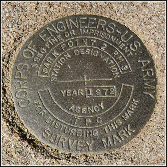
PARK POINT 2 RM 3 (HM0505)
Recovered in Good Condition on September 14, 2008
Spatial/elevation data
| Coordinates | N 37.280683° W 108.461566° |
| Elevation | 8581 ft. |
| Location | Colorado
Montezuma County Point Lookout Quad |
Mark description
| Type | Survey Mark |
| Setting | Square Concrete Monument |
| Monumented | 1972 by Defense Map Agency |
| Description (NGS) | NGS Datasheet |
Narrative and photographs
For more information about this reference mark, see its parent mark PARK POINT 8572.3.

