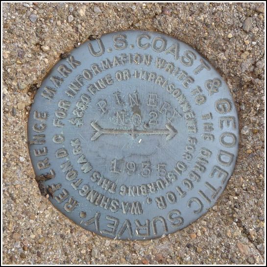
PINERY RM 2
Recovered in Good Condition on May 31, 2011
Spatial/elevation data
| Coordinates | N 32.00745° W 109.439666° |
| Elevation | Unknown |
| Location | Arizona
Cochise County Bowie Mtn South Quad |
Mark description
| Type | Reference Mark Disk |
| Setting | Square Concrete Monument |
| Monumented | 1935 by NGS |
Narrative and photographs
For more information about this reference mark, see its parent mark PINERY 2.
Note that this reference mark remains from the original PINERY station (see geocacher note from 2009); hence the older date of monumentation and the fact that it is stamped PINERY RM 2 rather than PINERY 2 RM 2.

