TheSurveyStation
Follow along with Zhanna as she searches for survey marks, airway beacons, and other relics of infrastructure!
Learn moreRecent Survey Mark Recoveries
Browse all recoveries »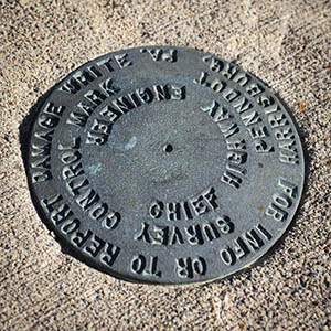
PennDOT (Unstamped, #7)
Lackawanna County, Pennsylvania
June 13, 2026
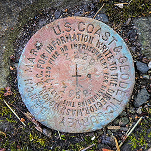
Z 229
Lackawanna County, Pennsylvania
June 9, 2026
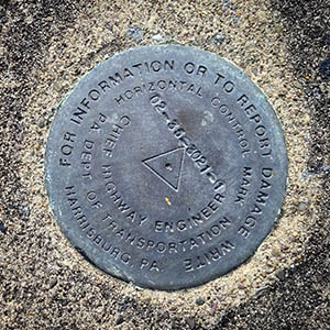
02-35-3021-1
Lackawanna County, Pennsylvania
June 9, 2026
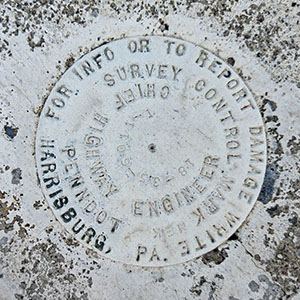
18-35-6011-1
Lackawanna County, Pennsylvania
May 27, 2026