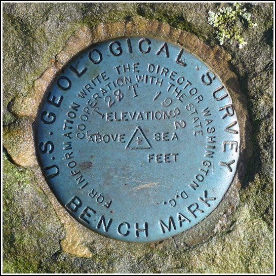
TT 28 T
TT 28 T
Recovered in Good Condition on December 4, 2012
Spatial/elevation data
| Coordinates | N 41.62559° W 75.60637° |
| Elevation | 1479.021 ft. |
| Location | Pennsylvania
Lackawanna County Clifford Quad |
Mark description
| Type | Bench Mark Disk |
| Setting | Rock Outcrop |
| Monumented | 1932 by USGS |
| Description (USGS) | Clifford (Clifford Corners), 2.0 mi S. of; 2.7 mi N. of Tompkinsville; 0.6 mi NW. of Clifford High School; 0.3 mi NW. of intersection of State Highway 647; 95 ft NE. from fork of rd. SW.; on property of W. J. Bell; in rock outcrop; standard tablet stamped “TT 28 T 1932” |
Narrative and photographs
There isn’t much better (in December, anyway) than a sunny, 64° day. We simply had to take advantage of our long morning by scouting out some probable benchmark locations near Clifford. We hadn’t even intended to get out of the car, but when I drove slowly past our plotted coordinates for TT 28 T and spotted a prominent outcrop in the woods with a bright blue spot on its high point, we had to take a closer look. The disk is set into an outcrop (approximately 3’ x 5’) in open woods just a few yards northeast of Hickory Ridge Road, and directly east of the T-intersection of Hickory Ridge Road and T-564 (Telep Rd.). The benchmark disk is in excellent condition.

 from Hickory Ridge Road.")
 mentioned in the description.")