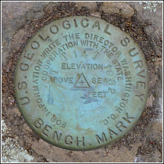
TT 14 T
TT 14 T
Spatial/elevation data
| Coordinates | N 41.58814° W 75.3686° |
| Elevation | 1275.066 ft. |
| Location | Pennsylvania
Wayne County Honesdale Quad |
Mark description
| Type | Transit Traverse Station Disk | ||||||
| Setting | Boulder | ||||||
| Monumented | 1932 by USGS | ||||||
| Description (USGS) | Waymart, 3.4 mi NE. of; on Delaware and Hudson Canal Company Gravity RR.; in angle formed by main line RR. and spur line to Keen Pond ice house; 218 ft S. of rd. crossing; 60 ft E. of rd.; in top of large flat rock; standard tablet stamped “TT STA NO 14 T 1932”
|
Narrative and photographs
This is our third consecutive weekend visiting the Waymart area for USGS benchmark hunting (… and pizza and BBQ from the Waymart Hotel). We haven’t come close to finding all of them yet! This area is rich in benchmarks, and also rich in railroading history. For years, Rich and I have read everything we could find about the local gravity railroads and have explored many of the old lift planes and structures of the Pennsylvania Coal Company’s gravity railroad on the Moosic Mountains near Dunmore. The last few weeks’ explorations have put us further east, in the territory of the Delaware & Hudson’s gravity railroad. I was so excited to see a benchmark description that actually mentioned the D&H Gravity and referred to the ice trade on Keen Lake. I spent the week in anticipation, fully aware that the area is now full of cottages and campsites. I didn’t really expect we’d find anything, but I had to look.
This morning, we made Keen Lake our first stop. We parked on North Elk Forest Drive, just about 100 feet from the coordinates I had pulled from the topo map. As we approached the house to the north of the road, we could see the large boulder that we suspected held the mark. No one was home, so we made our way through the yard (carefully avoiding the poison ivy that infests this entire area) toward the boulder. Rich laughed when he saw a small figurine of a frog perched on the highest point of the boulder. “I bet it’s underneath that frog!” he said. I had the same idea, but when I climbed up onto the boulder I cold see that the mark was set right in the middle, a few feet away from the frog. I brushed off the pine debris and found the disk in perfect condition underneath.
Although the disk is in excellent condition, Rich and I had to wonder why it was set into this boulder that appears to be sitting right on the surface of the ground rather than an embedded boulder or outcropping bedrock, as it typically used. I’m still going to call the condition “good” but with the caveat that I don’t know how much the boulder might have moved since the mark was set. The coordinates I recorded at the spot were within 20 feet of the coordinates I estimated from the topo map.
Little is left of the gravity railroad in this area. One structure can be seen clearly from Route 6: Gravity R.R. Structure on Keen Lake


