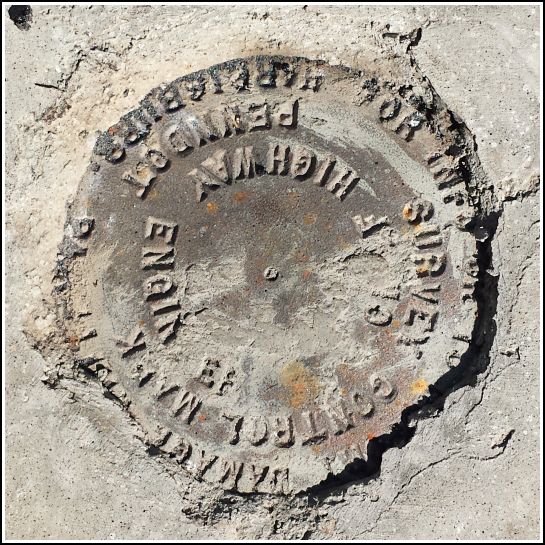
PennDOT (Unstamped, #4)
PennDOT (Unstamped, #4)
Recovered in Good Condition on July 11, 2014
Spatial/elevation data
| Coordinates | N 41.594604° W 75.766991° |
| Elevation | Unknown |
| Location | Pennsylvania
Wyoming County Factoryville Quad |
Mark description
| Type | Survey Control Mark |
| Setting | Concrete bridge headwall |
| Monumented | Unknown by PennDOT |
| Description (PennDOT) | Unavailable. |
Narrative and photographs
On our way back (along the currently detoured route) from our favorite farm stand on Route 438, I noticed that this small bridge had been rebuilt, and we stopped to look for a disk. We found one set into the new concrete, but it has no stamped designation. Rich thinks that PennDOT may be adding disks to new bridges just in case they’re needed in the future, and not necessarily surveying them until a later date. This makes sense to me. We’ve found several unstamped disks in newly-replaced bridges, and I’ve found a few older marks that were unstamped when I first found them, but were later stamped. Perhaps next year this mark will be stamped and we’ll have an update to this page!

