STILL
STILL
Spatial/elevation data
| Coordinates | N 40.377566° W 76.031083° |
| Elevation | Unknown |
| Location | Pennsylvania
Berks County Bernville Quad |
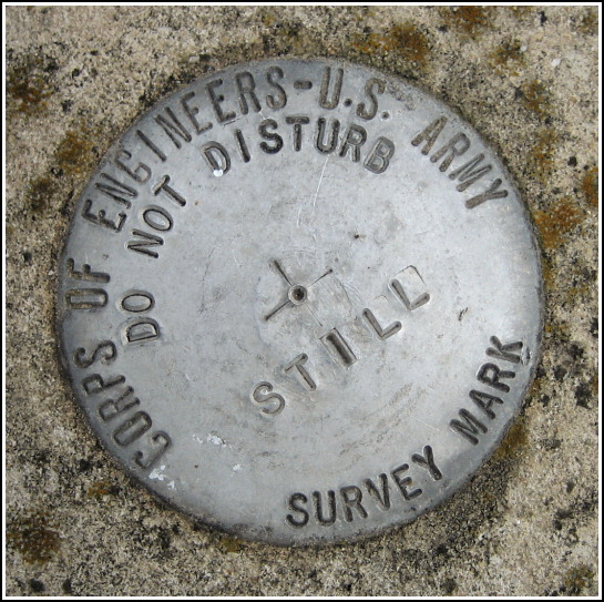
Mark description
| Type | Survey Mark |
| Setting | Round Concrete Monument |
| Monumented | Unknown by Army Corps of Engineers |
| Description (Army Corps of Engineers) | Unavailable. |
Narrative and photographs
STILL was an accidental find, like so many interesting marks, spotted while Rich and I were preparing to ride the trails at Blue Marsh Lake. It’s located in the grass just a few yards south of the Stilling Basin parking area. The bright orange carsonite post drew my attention from across the lot, and upon investigating, I noticed the mark at its base. It was only after our long, hot, crazy ride and a cool-down session in the creek nearby that I documented the mark with photos. This was a perfect end to an exhausting but exciting day!
We can only assume this survey mark has something to do with the Army Corps of Engineers dam here at the lake, but no further information is available. I’m certain that there are other marks scattered around, too, perhaps atop the dam itself, but we did not come across any others today. (We did spot another orange witness post at a trail intersection just a few miles into the ride, but a brief search yielded no mark nearby.)


