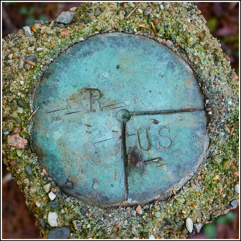
R/US
R/US
Recovered in Fair Condition on September 14, 2022
Spatial/elevation data
| Coordinates | N 44.308799° W 68.246167° |
| Elevation | Unknown |
| Location | Maine
Hancock County Seal Harbor Quad |
Mark description
| Type | Boundary Monument |
| Setting | Concrete Post |
| Monumented | Unknown by Unknown Agency |
Narrative and photographs
This was the final of four R/US boundary markers that we found along the Seaside Path during our hike today. This one is quite strange! It is a corner marker, and for some reason the concrete monument is set well above the surface of the ground on a piece of rebar. I’ve never seen anything like this!

