WHITEFACE MTN (PG2112)
WHITEFACE MTN
Spatial/elevation data
| Coordinates | N 44.365783° W 73.903067° |
| Elevation | 4866 ft. |
| Location | New York
Essex County Lake Placid Quad |
Mark description
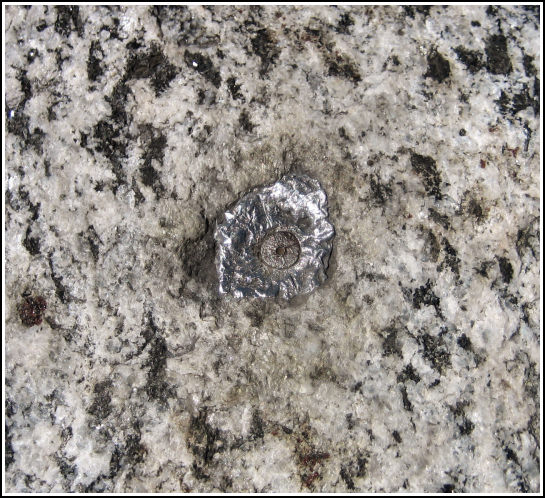
| Type | Lead Bolt |
| Setting | Bedrock |
| Monumented | 1880 by Adirondack Surveys |
| Description (NGS) | NGS Datasheet |
NGS recovery information
Descriptive text
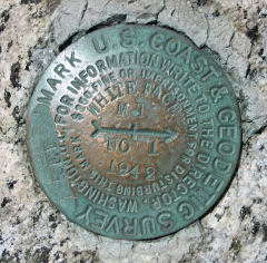
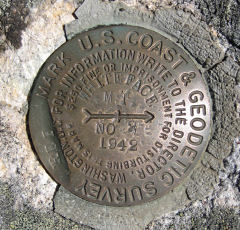
The station mark and reference marks 1 and 2 were recovered in good condition. The azimuth mark was not searched for at this time. The 1976 description remains accurate.Narrative and photographs
On the final day of our “Adirondack Mini-adventure,” Rich and I decided to investigate Whiteface and see what all the fuss was about. I was intrigued by the mention of both a castle and a tunnel … and the presence of a tri-station at the summit made the trip imperative. We had originally hoped to watch the sunset from Whiteface two days before, but discovered when we reached the toll gates that the road had closed early in the evening. It’s just as well, because visiting the summit during this warm, dry, sunny mid-morning was a beautiful experience. We could see for many miles and were able to identify most of the high peaks and the nearby lakes. We were also, with minimal intrusion from the swarms of tourists at the summit, able to find and document the station mark and both reference marks. We found all three to be in good condition and as described by NGS in 1976. On our next trip, we’ll attempt to locate the azimuth mark!


| Designation | Status | Condition | Image |
|---|---|---|---|
| WHITEFACE MTN RM 1 | Recovered | Good |
|
| WHITEFACE MTN RM 2 | Recovered | Good |
|