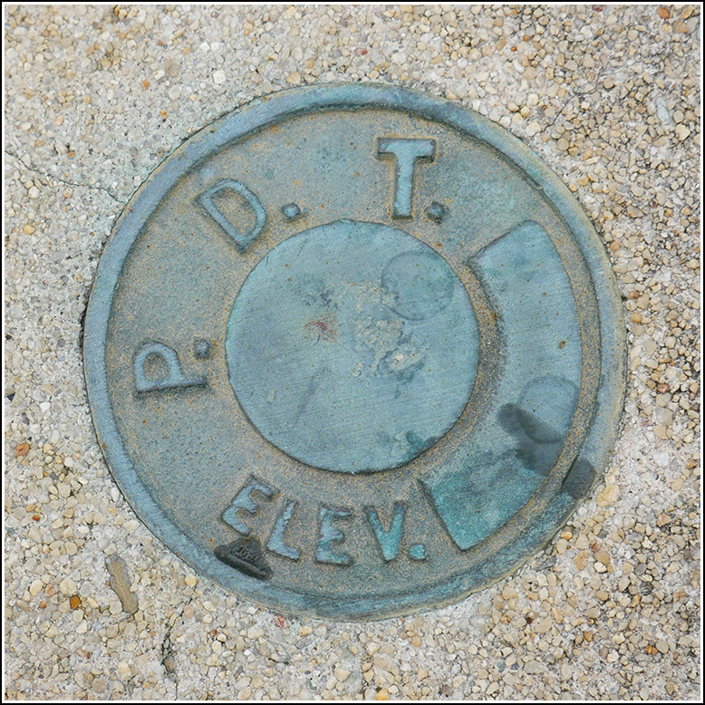
PennDOT (Unstamped, #6)
PennDOT (Unstamped, #6)
Recovered in Good Condition on April 28, 2019
Spatial/elevation data
| Coordinates | N 40.847277° W 75.448922° |
| Elevation | Unknown |
| Location | Pennsylvania
Monroe County Kunkletown Quad |
Mark description
| Type | Elevation Mark |
| Setting | Bridge Parapet Wall |
| Monumented | Unknown by PennDOT |
Narrative and photographs
We always take the fun route over the ridge when we go to Point Phillips. It’s narrow and winds around and around up to Smith Gap and then down again—almost like a very tiny Moki Dugway. We pass through Kunkletown before heading up the mountain, and this time when we turned onto Chestnut Ridge Road Rich happened to notice a survey mark on one of the corners of the bridge. It’s a PDT mark (older than the new PennDOT disks but newer than the PDH disks). Unfortunately it has no stamping, so we don’t know its designation or date. The mark is in good condition.

