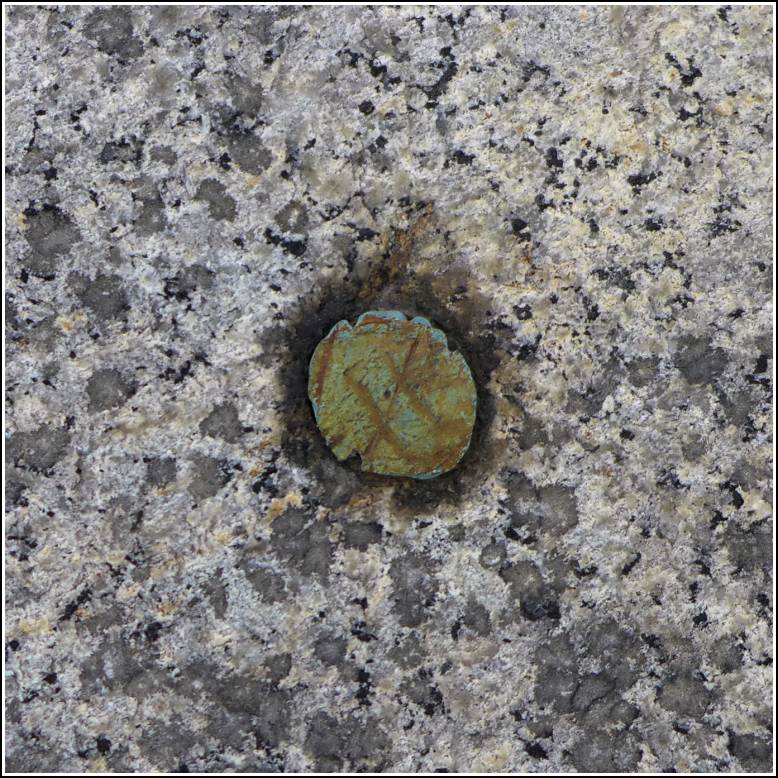
FORT KNOX 1863 (PE2186)
FORT KNOX 1863
Spatial/elevation data
| Coordinates | N 44.565736° W 68.802258° |
| Elevation | 141 ft. |
| Location | Maine
Waldo County Bucksport Quad |
Mark description
| Type | Copper Bolt |
| Setting | Rock Outcrop |
| Monumented | 1863 by NGS |
| Description (NGS) | NGS Datasheet |
Narrative and photographs
We made our way slowly to the top level of the fort, exploring and taking photos along the way. Once we got to the top, we began to look for the station, which in this case is a bolt. Oh, great, it’s on top of the roof of the fort directly above a sign that says “Danger - do not climb on roof.” I’m not one to let a sign stop me when I know I’ll be careful and responsible for myself (and won’t cause any damage), but I still didn’t want to be chased off before I could get a photo of the station, at the very least.
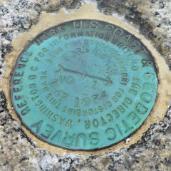
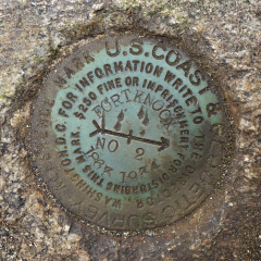
We found the first reference mark easily without having to go up on top of the roof. A little more searching led to the supposed location of RM 2, near the east corner of the second ventilator shaft, but we couldn’t find the disk. We assumed it was beneath the heavy mat of soil and debris that had encroached on the concrete of the shaft. It would take some work to clear the debris, so I moved on to find the bolt, which is set out on the stone roof of the fort. I was able to get close enough to take some reasonably good photos. Then we searched again for RM 2. I grabbed the mat of soil and roots and tugged it back away from the concrete while Rich looked underneath. The disk was so well covered and filled in with soil, it actually took us a minute to realize we had uncovered it! Once we spotted it, we cleaned it off well enough to take some photos. All three marks are in good condition.


| Designation | Status | Condition | Image |
|---|---|---|---|
| FORT KNOX RM 1 | Recovered | Good |
|
| FORT KNOX RM 2 | Recovered | Good |
|