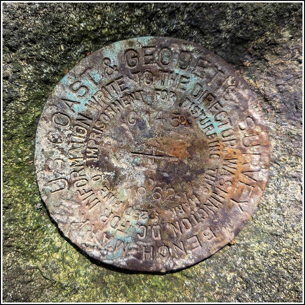
G 145
Spatial/elevation data
| Coordinates | N 44.25976° W 68.385406° |
| Elevation | 97.18 ft. |
| Location | Maine
Hancock County Bartlett Island Quad |
Mark description
| Type | Bench Mark Disk |
| Setting | Rock Outcrop |
| Monumented | 1962 by NGS |
| Description (NGS) | NGS Datasheet |
Narrative and photographs
G 145 was the only benchmark we had on our list for today. JRO’s use of the phrase “in heavy woods” in his description made me a little hesitant; he seems like a pretty tough guy, so I was afraid I’d be entering a nearly impenetrable thicket. But thankfully, it wasn’t too bad, especially once I found the very short path leading directly to the mark from the road shoulder. The only hazard there was a thorn bush that was easily avoided.
Of course, when I first approached the mark, I came in from the side road near the cemetery where Rich had parked, and those woods were thicker! But it was easy enough to spot the ledge from a distance, and strangely enough the top of the ledge was completely clear of moss and debris, so the mark was easy to find and photograph. The mark and ledge are in good condition. I tied some flagging tape around two nearby trees to help indicate the mark for future users.


")
