TIDAL 4 STA 13 (PE0311)
TIDAL 4 STA 13
Recovered in Good Condition on September 17, 2017
Spatial/elevation data
| Coordinates | N 44.241573° W 68.35257° |
| Elevation | 5.53 ft. |
| Location | Maine
Hancock County Bass Harbor Quad |
Mark description
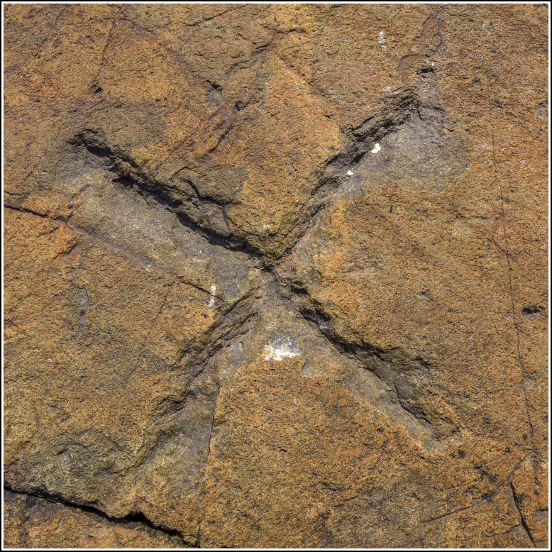
| Type | Chiseled Cross |
| Setting | Rock Outcrop |
| Monumented | Unknown by NGS |
| Description (NGS) | NGS Datasheet |
NGS recovery information
Descriptive text
Recovered in good condition as described in the 2010 recovery note.Narrative and photographs
See also: Shared Solution for TIDAL 4 STA 13
This is a tidal mark like TIDAL 6 STA 13 nearby, but rather than a disk, it’s a cross chiseled in an outcrop. This is quite unusual in my experience, so I was excited to look for this mark. After we found TIDAL 6, I walked across the shell- and seaweed-covered beach (which wasn’t as slippery as it looked) toward the ledge. The cross is a bit difficult to spot, but it’s about two feet south of a metal rod protruding from the ledge, so that should help to locate it. This mark may be difficult to reach at high tide!

