TIDAL 8 STA 11 (PE0283)
TIDAL 8 STA 11
Spatial/elevation data
| Coordinates | N 44.390583° W 68.204267° |
| Elevation | 41.79 ft. |
| Location | Maine
Hancock County Bar Harbor Quad |
Mark description
| Type | Tidal Bench Mark Disk |
| Setting | Granite Bench |
| Monumented | 1947 by NGS |
| Description (NGS) | NGS Datasheet |
NGS recovery information
Descriptive text
Photos of the mark in place in 2002 and of the current situation were submitted to NGS, which has marked this station officially Destroyed in the database.Narrative and photographs
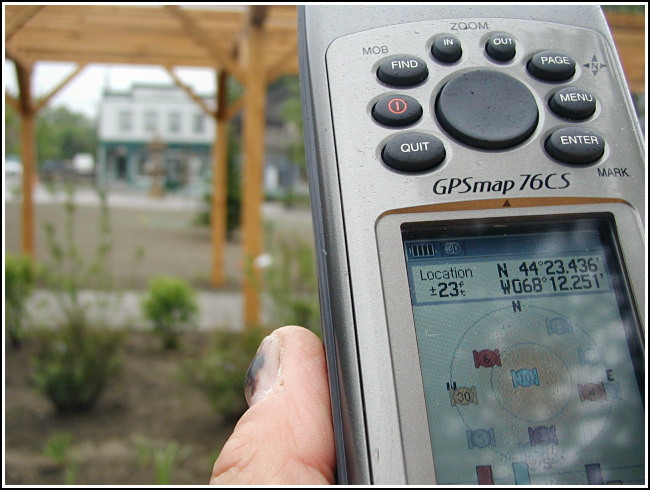
After breakfast on our last day in Bar Harbor, Aaron, Rich and I took a long, slow (wet) walk around town and decided to document three marks near the waterfront that have gone missing. The bench this mark was set into has been removed from the site, as part of the current reconstruction project at the park.


(Recovered on September 11, 2002)
N 44° 23.435’ W 068° 12.256’
While vacationing on M.D.I. I decided to search for a few local benchmarks. This one, like many of the others I had hunted, was found during a very pleasant after-breakfast walk around town. The mark was relatively easy to find using the historical description. At the station my Garmin GPSmap76 receiver indicated approximately 273 feet from the posted coordinates. The disc is quite visible and is in excellent condition. I must’ve walked by this mark at least a hundred times in the 30 years I’ve been coming here! ~Rich in NEPA~


