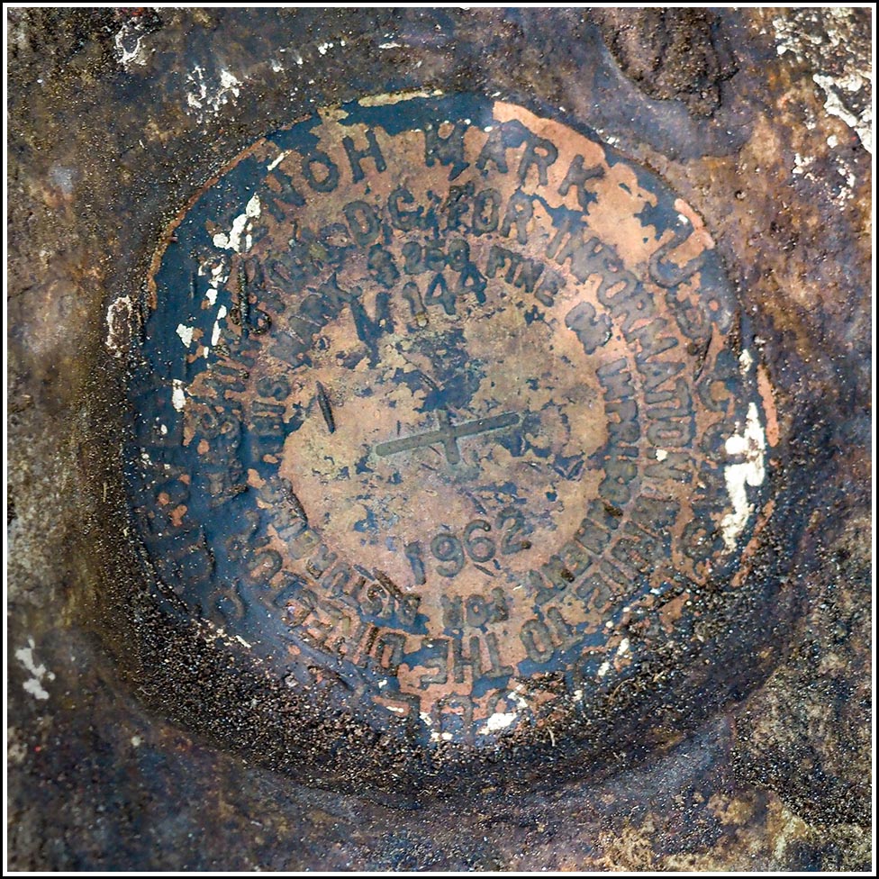
M 144
Spatial/elevation data
| Coordinates | N 44.408226° W 68.351361° |
| Elevation | 30.43 ft. |
| Location | Maine
Hancock County Salsbury Cove Quad |
Mark description
| Type | Bench Mark Disk |
| Setting | Boulder |
| Monumented | 1962 by NGS |
| Description (NGS) | NGS Datasheet |
Narrative and photographs
Thanks again to JRO, we were pretty confident that we could find this mark. He described a large boulder and even specified where on the boulder the mark was set, which helped a lot in knowing where to clear off the surprising amount of soil, roots, and leaves that had accumulated since his visit only two years ago. Because, and only because, of his precise description, I was able to find the mark pretty easily. The layer of soil and roots pulled off pretty easily, and we just had to pull and cut a few extra roots, and brush away some loose soil, to clean off the area quite well. There was some evidence of fluorescent orange paint around the mark, but nothing recent. The stamping is also pretty faint and tricky to read, but ultimately it is legible. Note that while we parked at the nearby automobile dealer, we initially entered from the highway side, but this was messy and difficult walking. It is much easier to enter from the north end of the dealer lot, where there is essentially a path that enters the woods, from which it is very easy to reach the mark (just a few meters’ walk through mostly open woods).


")
 of this building")